Description
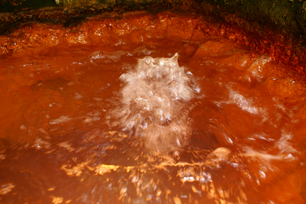
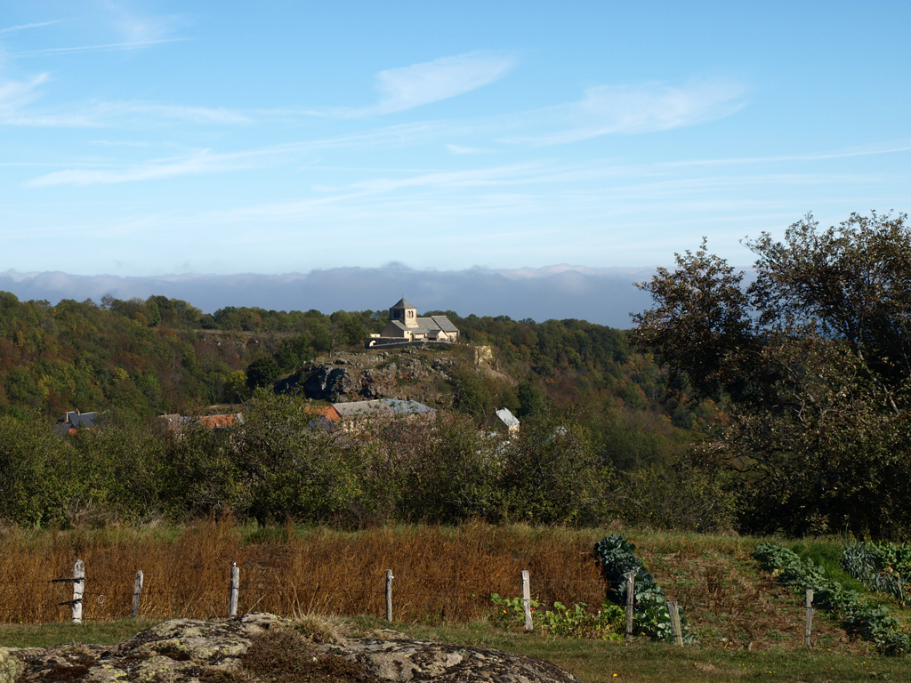
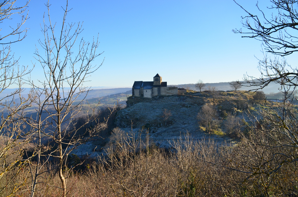
From Ternant-les-Eaux, the path leads to the chapel of Dauzat-sur-Vodable perched on a volcanic peak. The descent into the forest leads to several ferruginous springs.
Starting point - From the starting sign (Romanesque church, bread oven, old well, old washhouse, water trough) go up the steep street behind the church chevet. At the last house turn right on the asphalt road until you reach a first road on the left. Take it to the road.
1 - Go up the road for 10 m, turn right and climb a stony path. At the top follow the asphalt road on the right and then the first asphalt road on the left until you reach the road. Take this one on the right then a wide track on the left up to a crossroads. Turn right to reach a crossroads (view of the hillock of Vodable and the Puy d'Ysson).
2 - Go down to the right, ignoring the right and left paths to the bottom of the valley. Continue straight ahead until you reach the crossing on the plateau (360° viewpoint: view of the Sancy massif, the Puys chain, the Allier plain, the Livradois-Forez mountains).
3 - Turn left. Continue until you reach the T-junction in front of a dry-stone hut. Turn right and then left 150 m further on. At the crossing, continue straight ahead towards Dauzat-sur-Vodable (view of the priory and the site of the old castle) until you reach the war memorial.
4 - Cross the road, go down to the left on the asphalt road then grassy. Continue in the undergrowth. Leave a path on the left. At the next crossroads, continue straight on the main road on the ridge until you reach a footbridge crossing Rivaux Creek.
5 - Take it, then cross a step ladder. Cross the meadow and take the path in the valley along the stream (ferruginous source). In a curve, leave a path to the right. Join the D148 which brings you back to the starting point.
- Entity information:Office de Tourisme Auvergne Pays d'Issoire
Profile
- Altitude max. itinerary:910 m
- Altitude difference:415 m
- Positive elevation gain:415 m
- Markup accuracy:Yellow
- Route type:Loop
- Distance:11,5 km
- Daily duration:03h15
Activities
- Pedestrian sports
- Hiking itinerary
Services / Equipment
- Pets allowed
- Pets welcome
Opening
From 01/01 to 31/12.
Subject to favorable weather.
Tourist Office of Pays d'Issoire
9 place Saint Paul -
63500 ISSOIRE
Near abbey-church Saint-Austremoine
+33 (0)4 73 89 15 90
Opening hours during school terms
From Monday to Friday from 2:00 PM to 5:00 PM and Saturday from 9:30 AM to 12:30 PM
Opening hours during school holidays
From Monday to Saturday from 09:30 AM to 12:30 PM and from 2:00 PM to 5:30 PM
Opening hours during summer holidays
From Monday to Saturday from 09:30 AM to 6:30 PM and Sunday from 10:00 AM to 12:30 PM and from 2:00 PM to 6:00 PM
Credits -
Site map -
-
Legal notice -
Made with by IRIS Interactive
Back to top
Ce site est protégé par reCAPTCHA. Les règles de confidentialité et les conditions d'utilisation de Google s'appliquent.

 UK
UK
 FR
FR