Description
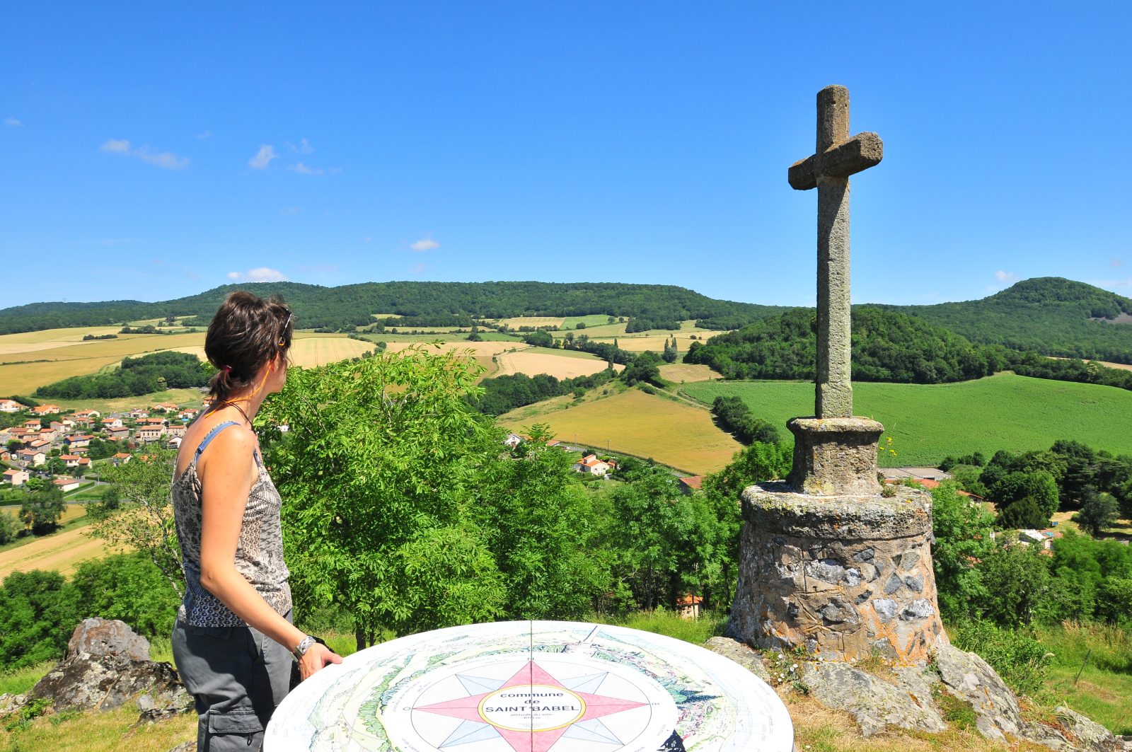
This walk will delight sports enthusiasts eager for vertical drops and contrasting paths. In Saint-Babel, a panoramic view of the Issoire basin and the cereal plain. This hike offers beautiful unobstructed views and crosses many small built heritage sites.
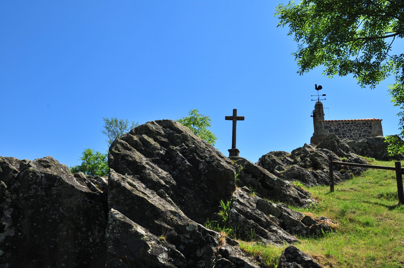
Starting point - From the starting sign, at the foot of the city, follow the signs "Direction Table d'orientation", "Butte du Château". Climb to the top (360° view) of the site of Château d'Ybois. Go around the hill to the left and go down to the starting point.
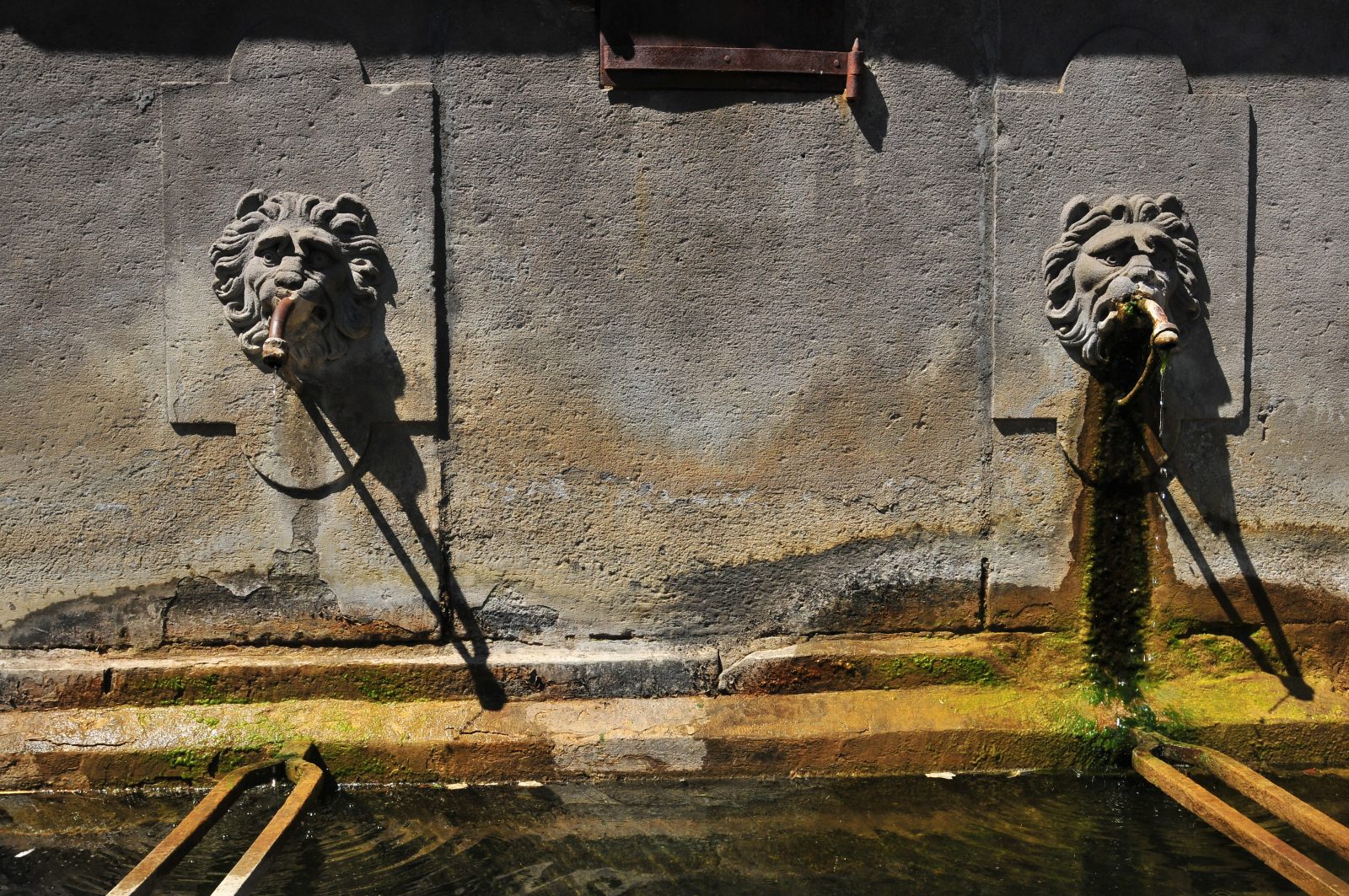
1 - Take the direction of Sauxillanges. At the fountain, go down on the left rue des Charnats. Continue rue de l'Abattoir. Cross the road. Take the rue des Pageix and go down towards Bas Maisons (washhouse). Cross a small bridge and continue on the road to Les Fougères. At the fountain, turn left. At the fork, turn right, go through Suchère, to the left of Château de la Suchère (view of Nonette and Montcelet). 150 m after the houses, go down left on a grassy path to La Malcourtie. On the square (fountain), stay to the left and go down a stony path ignoring the street on the right. 50 m further on, turn to the right on a grassy path. At the crossroads with the road, continue opposite, then turn right onto the grassy path that leads to the first houses of Flat. Turn left and go to the D9.
2 - Take the D9 on the right, go past the fountain, turn left before the War Memorial, then go to the right of the church. Continue to the right, then to the left on the D9 for a few meters. Turn right on Chemin de la Pellière. When you arrive in Les Echallats, keep to the left. Take the first road on the left and continue straight ahead towards Les Escures. At the entrance to the hamlet, ignore the road on the left and the street on the right and walk along the houses. At the crow's feet, leave the road and take Les Eversins road. Climb (view of the Livradois). Pass in front of the Ybois castle. Go down to La Barberie (view of the Sancy massif and then Issoire), ignoring a path on the left. Just after La Barberie, take the first grassy road on the left. At the crossroads, continue in front. At the next intersection, turn right. Ignore the path on the right. At Les Escures, take the road on the left and follow it, ignoring the roads on the right and left. At the fork, go down to Naves.
3 - At the 1st street, turn right, take left on rue de la Fontaine. Place de la Fontaine (cross and fountain), turn right. Cross the Issoire road and go up the small street opposite. Continue along the steep path in the undergrowth. Turn right. At the Straw exit, take the road to the left. At the first road on the right, go down and at the first curve, turn left. Cross the Fumades. Take the road on the left towards La Laye, before the small bridge, leave the road and turn left, then immediately to the right, a long and ravine climb. At the crow's feet (cross), go down to the right by a road. Cross Roure by the main street (washhouse, fountains). At the next fountain, turn right. Continue on the road ignoring the right lane. After the bridge, turn left on the grassy road. Continue up to the road. Cross it and continue straight ahead until you reach the starting point.
- Entity information:Office de Tourisme Auvergne Pays d'Issoire

 UK
UK
 FR
FR