Description
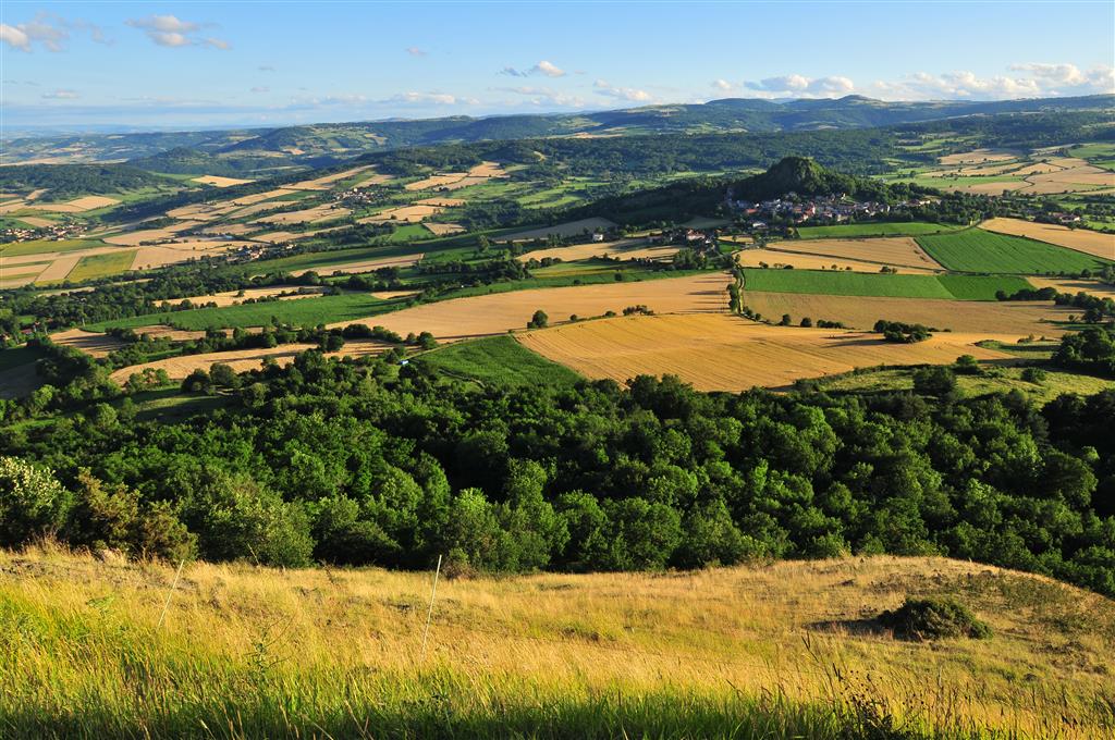
Part of the Pays d'Art et d'Histoire of Issoire Val-d'Allier, the path offers a view of the Lembron and its cereal fields and the Pays des Couzes from the summit of the puy d'Ysson (856 m). The volcano is frequented by paragliding enthusiasts.
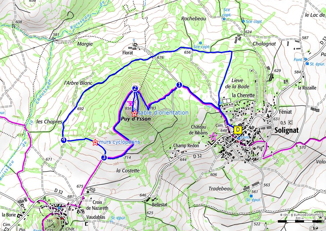
Starting point - From the car park located 50m above the starting sign, go up the street and walk along the cemetery. 50m after a cross, turn left to the picnic area.
1 - Take the track on the left and then the first path on the right which climbs into the oak grove amidst the remains of old buildings. When you reach the road, turn right until you reach the bend.
2 - Leave the road and take the downhill path (round trip option: continue on the paved road until the top of the peak - 360° panorama, orientation table). Halfway, viewpoint on the hilltop of Vodable. Continue until you reach a T-junction.
3 - Go up to the right (300m further on, cyclopean walls with stone shepherd's hut). Then the path goes down by taking a stone path that leads to an agricultural path.
4 - Take it to the right, then leave it and continue straight ahead. Cross the Florat road and continue opposite on the grassy path, ignoring the right and left paths until you reach the crossing under the power line.
5 - Go up to the right and at the top go straight down to Solignat.
- Entity information:Office de Tourisme Auvergne Pays d'Issoire
Profile
- Altitude max. itinerary:856 m
- Altitude difference:250 m
- Positive elevation gain:250 m
- Markup accuracy:Yellow
- Route type:Loop
- Distance:8 km
- Daily duration:02h45
Activities
- Pedestrian sports
- Hiking itinerary
Services / Equipment
- Pets allowed
- Pets welcome
Opening
From 01/01 to 31/12.
Subject to favorable weather.
Tourist Office of Pays d'Issoire
9 place Saint Paul -
63500 ISSOIRE
Near abbey-church Saint-Austremoine
+33 (0)4 73 89 15 90
Opening hours during school terms
From Monday to Friday from 2:00 PM to 5:00 PM and Saturday from 9:30 AM to 12:30 PM
Opening hours during school holidays
From Monday to Saturday from 09:30 AM to 12:30 PM and from 2:00 PM to 5:30 PM
Opening hours during summer holidays
From Monday to Saturday from 09:30 AM to 6:30 PM and Sunday from 10:00 AM to 12:30 PM and from 2:00 PM to 6:00 PM
Credits -
Site map -
-
Legal notice -
Made with by IRIS Interactive
Back to top
Ce site est protégé par reCAPTCHA. Les règles de confidentialité et les conditions d'utilisation de Google s'appliquent.

 UK
UK
 FR
FR