
 UK
UK
 FR
FR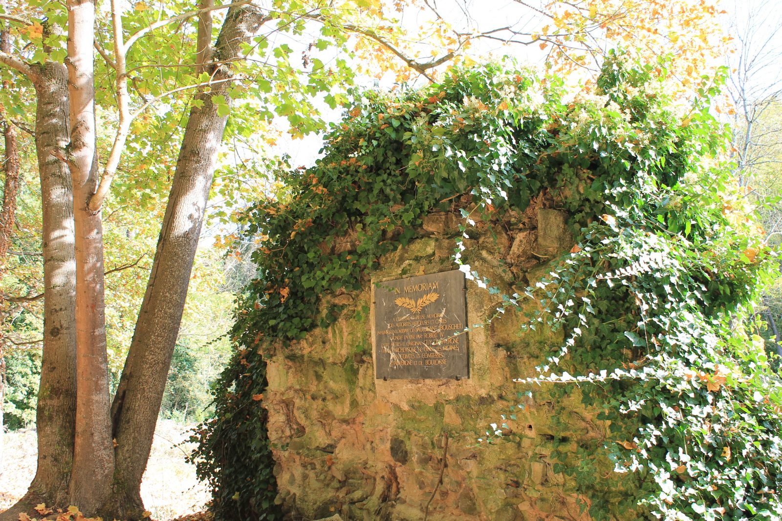
Description
Starting point - Cross the departmental road, take the "Chemin de l'Abbaye". At the bottom of the valley, cross the bridge and turn left. Go past the ruins of the Abbey of Bouschet (commemorative plaque), cross the D760 and go up in front. Take the first path on the left, first in the undergrowth and then in the middle of the vines up to a T-junction.
1 - Take the track which rises to the right. Leave the first path on the left (view on the castle of Buron, the hills of Lembron, the Cézallier, the Sancy massif, the Puys chain). At the crossroads of five paths, continue on the main path to the top of the hill.
2 - Turn right. Take the first road on the left at the level of a large scree, then the first road on the right which joins a road on the left to Yronde-et-Buron. After the first houses, turn right and take the street "Sous les Treilles" until you reach a crossroad (crossroads with other PRs).
3 - Take the small road on the right which goes down between gardens, go up leaving a path on the right up to a road. Turn right for about 400 m to reach another road. Take it to the right. 150 m further on, take the path on the left in the undergrowth, until the next crossing.
4 - Turn left up into the forest. At the T-junction, turn left. Leave a path successively to the left and then to the right. At the fork, after leaving the wood, turn right. At the next crossing, continue straight ahead (viewpoints: Livradois, Lembron, Cézallier, massif du Sancy and the Puys chain). Go down to the undergrowth, leave the first path on the left and go up to the right. The itinerary describes a wide loop on the right while going down quickly (views on the Val d'Allier, Issoire, Lembron and Cézallier). Continue, leaving a path on the right, until you reach a large T-junction.
5 - Turn to the right and continue on a good path which goes down towards Fontcrépon. Before the first houses, take a path on the left, cross the village and get back to the starting point.
- Entity information:Clermont Auvergne Volcans - Bureau d'information Touristique d'Aydat
Profile
- Altitude max. itinerary:672 m
- Altitude difference:315 m
- Positive elevation gain:315 m
- Markup accuracy:Yellow
- Route type:Loop
- Distance:11,5 km
- Daily duration:03h30
Prices
Free access.
Activities
- Pedestrian sports
- Hiking itinerary
Services / Equipment
- Pets allowed
- Pets welcome
Opening
From 01/01 to 31/12.
Subject to favorable weather.
Spoken languages
Customer type
- Level bue - Medium