Description
This plateau of summer pastures offers panoramic views of the points of the Massif Central. Its natural spaces conceal many treasures: peat bogs, lakes and waterfalls....
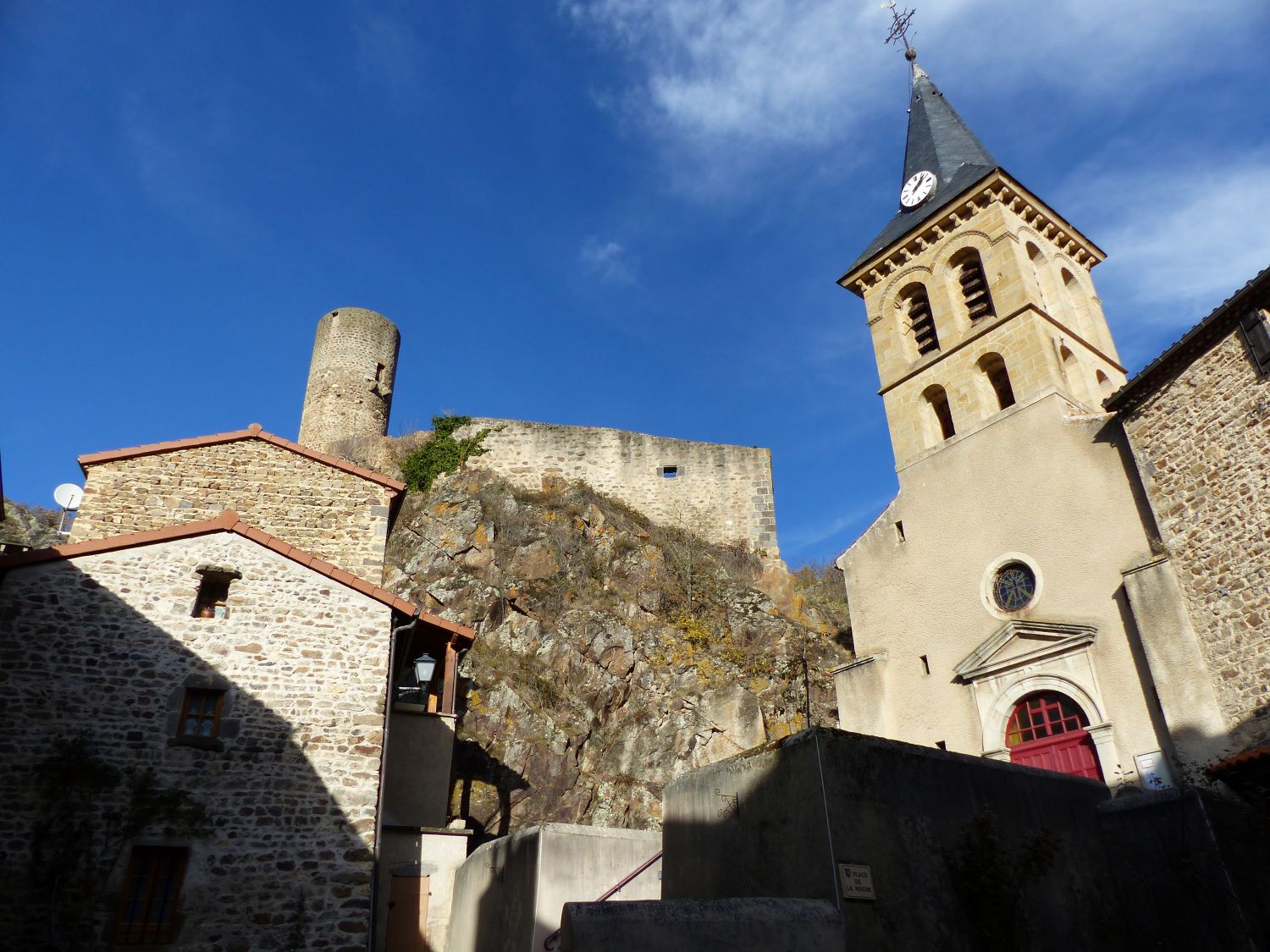
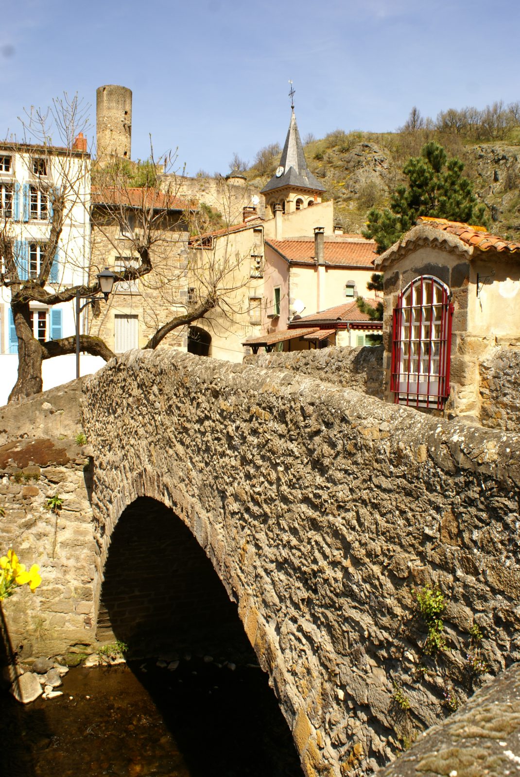
Starting point - From the Place du Marronnier, cross the Couze on the old bridge, (16th century Pède bridge, oratory housing a polychrome wooden virgin with a child), follow the D627 towards the church of Chastel, until the sign indicating the exit of Saint-Floret. Turn left at the cross. Go up to the road, follow it on the right, and then turn right again for 50 m.
1 - Turn left onto a wide track. At the fork, go up on the left, in the middle of the orchards. Take the road on the right, then the first track on the left. Follow it straight on, until you reach a new fork at the entrance to the village of Orphange.
2 - Leave the three drinking troughs on the left, cross the village. At the exit, continue straight on the road (view on Sancy and the peak of Brionnet). In the village of Le Montel, turn left. After the last houses, climb between hedges to a wide path. Take it to the right for 50 m (viewpoint), then turn left on the first path up to the Chaubasse plateau (at the top, very wide panorama). Always go down the same path (leave the transversal paths) to the hamlet of Chazeras.
3 - Turn left, pass in front of the water trough and the washhouse. Continue straight ahead on the hillside. At the fork, follow the right track, until you reach a T-junction.
4 - Go down to the right (view of the Couze valley and its various villages, as far as Issoire), pass under the high voltage line and take the first path on the left until you reach the road you cross.
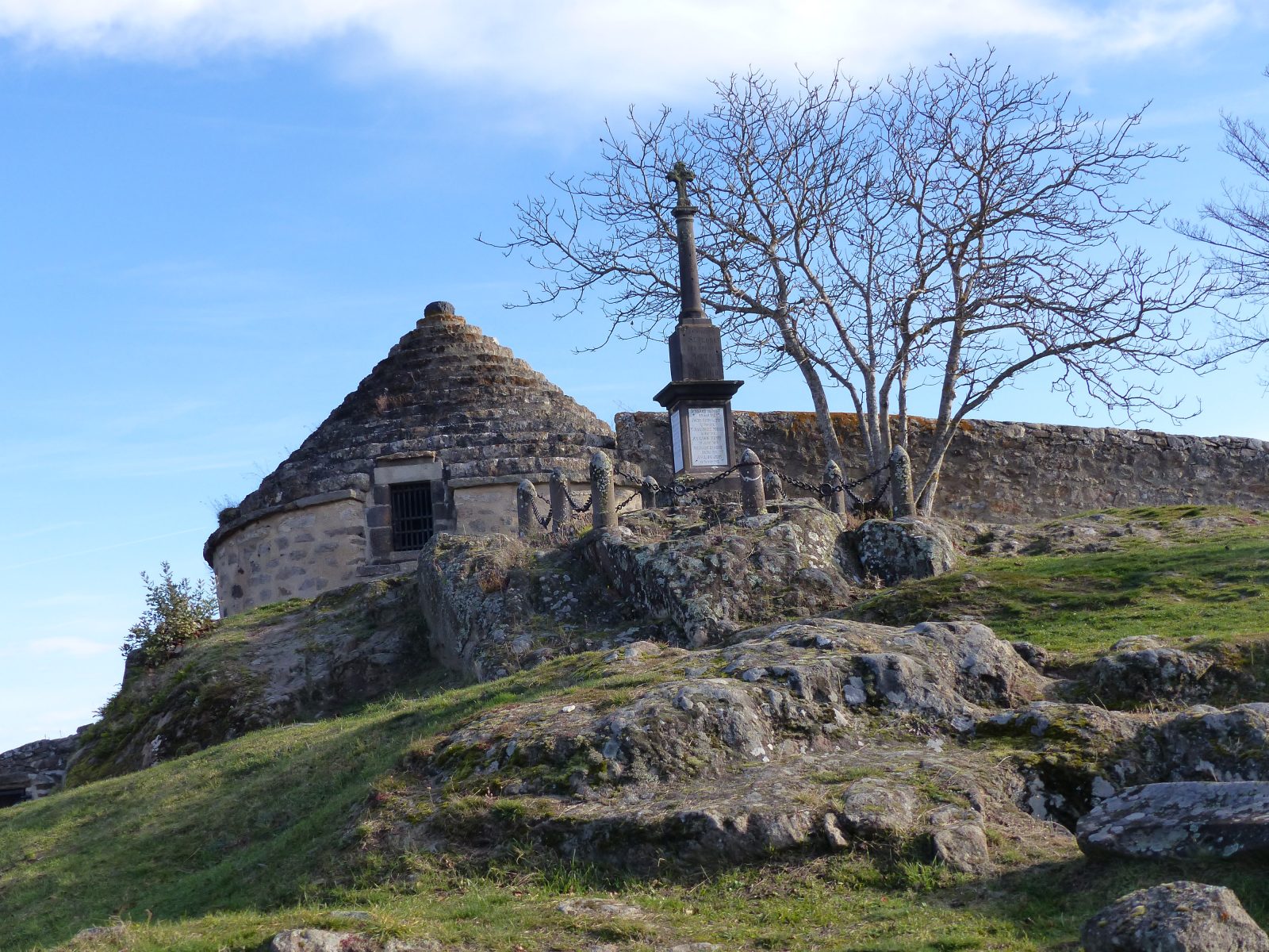
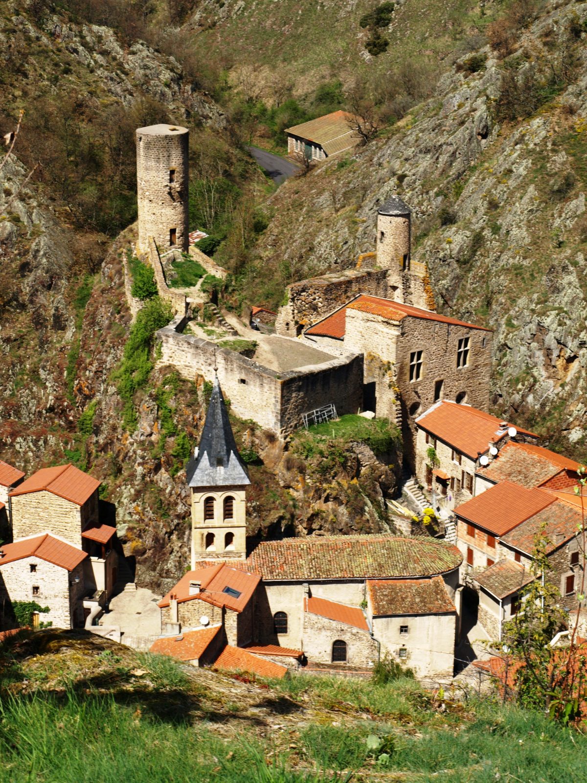
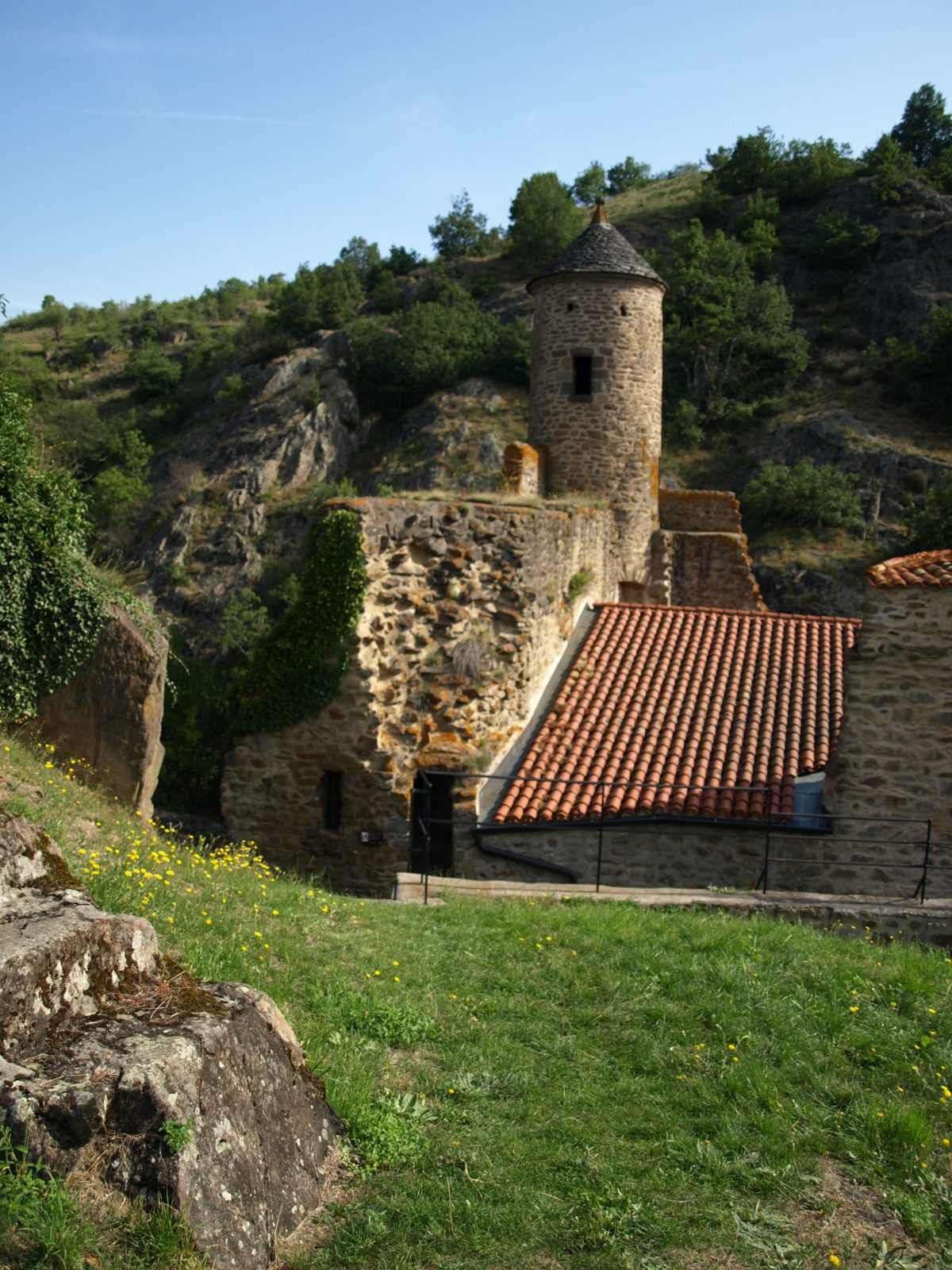
5 - Possible return to the Chastel site (chapel, ossuary, necropolis). Go down to Saint-Floret by the grassy path, to the right of the hill (Way of the Cross and halfway down the hill, stone cross engraved with a heart, view over the village and the castle). At the road, turn right, cross the Couze on the footbridge, and follow the road on the left to reach the starting point.
- Entity information:Office de Tourisme Auvergne Pays d'Issoire

 UK
UK
 FR
FR